 UWindsor GIS Day 2019
![]() UWindsor GIS Day 2019
UWindsor GIS Day 2019
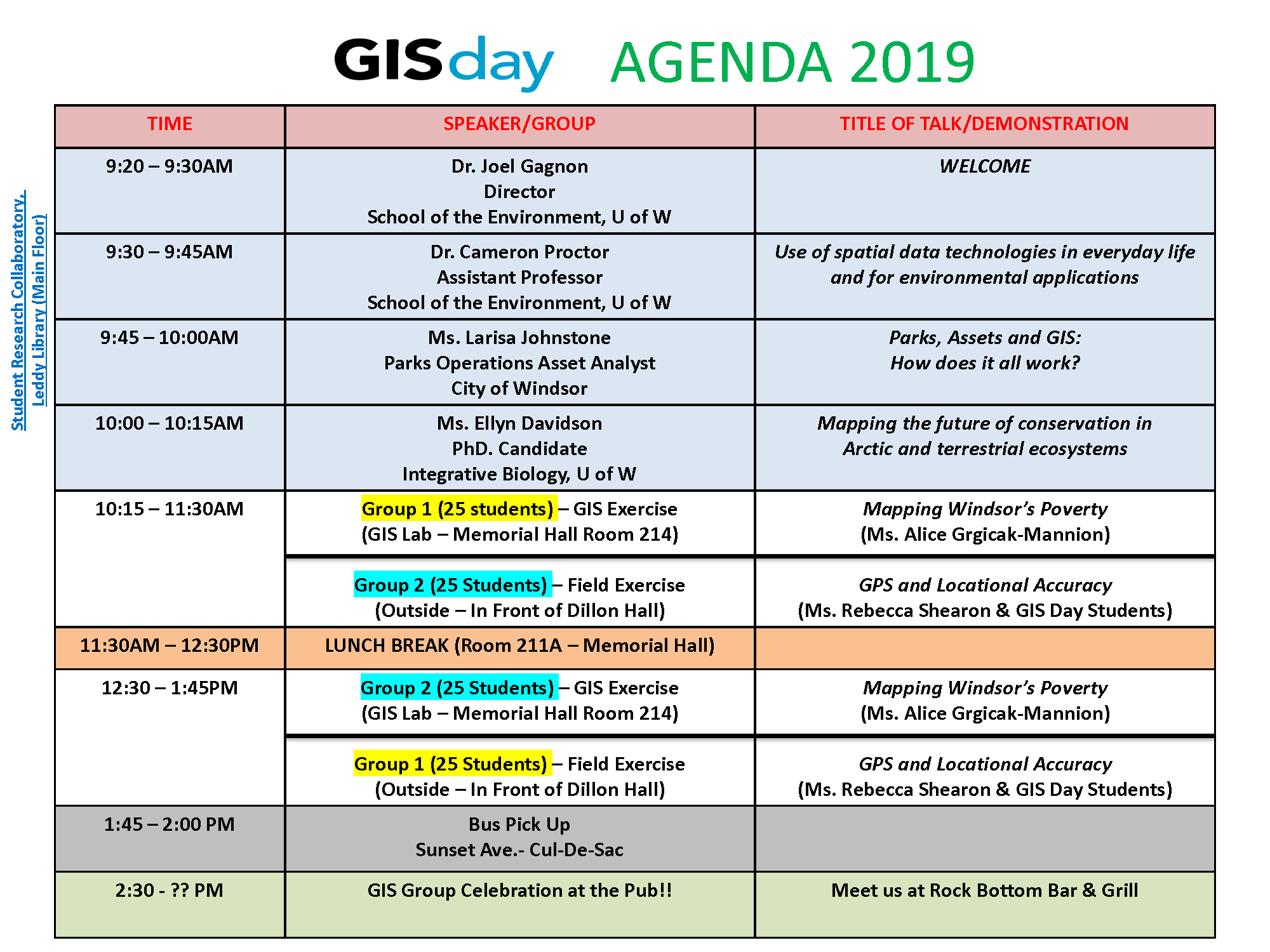
GIS Day is an annual international event that gives the public and users the opportunity to: celebrate geographic information systems (GIS) and other geospatial technologies; explore and promote the benefits of GIS; showcase the real-world applications of GIS; and build and nurture our local GIS community. Our event will feature guest speakers from the Windsor-Essex community, who will discuss how they utilize geospatial technologies in their occupations as well as the impact and contribution their work makes on and to society. Also, 50 high school students from Holy Names HS will be participating exclusively in an interactive, instructor-led demonstration using GIS software in our on-campus laboratory and partaking in field exercise using global positioning systems (GPS).
Due to limited space for this event we have already reached our capacity, but if you are interested in participating in GIS Day next year, please contact Ms. Alice Grgicak-Mannion at grgica3@uwindsor.ca.